Usòrò:Muddy Water Red desert.jpg
Otu nyochaa a ha:800 × 600 piksels Ndị ọzọ mkpebi:320 × 240 piksels | 640 × 480 piksels | 1,024 × 768 piksels | 1,280 × 960 piksels | 2,560 × 1,920 piksels.
Failụ si na nke mbu (2,560 × 1,920 pixel, ívù akwukwo orunótu: 2.23 MB, MIME nke: image/jpeg)
Mmẹkụwátá
| Nkówá |
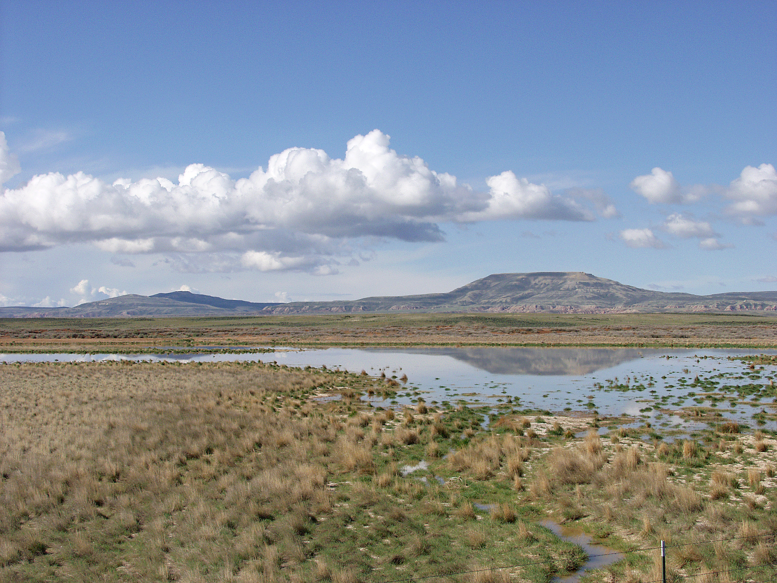
English: Melting snowpack is the primary source for surface water in Wyoming, such as this emphemeral wetland in the Muddy Creek Watershed of the Red Desert. This stretch of rangeland is typical of the vast expanses of publicly owned rangeland that aerial remote sensing is particularly well-adapted to. |
| Ǹgụ́ụ̀bọ̀chị̀ | Unknown date |
| Mkpọlọ́gwụ̀ | http://www.ars.usda.gov/is/graphics/photos/feb06/d423-1.htm |
| Odé ákwụ́kwọ́ | US Department of Agriculture. Sam Cox |
| Ọdà (Í jí kwá usòrò nke) |
US Federal Government work |
Nkwényé
| This image is in the public domain because it contains materials that originally came from the Agricultural Research Service, the research agency of the United States Department of Agriculture.
|
Ịta nke usòrò
Bìri èhì/ogè k'ị hụ òtù ụ̀fa dị̀ m̀gbè ahụ̀.
| Èhì/Ogè | Mbọ-aka | Ógólógó na asaá | Òjìème | Nkwute | |
|---|---|---|---|---|---|
| dị ùgbu â | 17:05, 21 Eprel 2009 | | 2,560 × 1,920 (2.23 MB) | Fishdecoy | {{Information |Description={{en|1=This stretch of rangeland in the Muddy Creek Watershed in Wyoming’s Red Desert is typical of the vast expanses of publicly owned rangeland that aerial remote sensing is particularly well-adapted to.}} |Source=http://www |
Ojiji faịlụ
Ihe ndị na-eso 2 ihe eji Ihu akwụkwọ eme na faịlụ a:
Ejiji failụ zụrụ ọha
Wikis ndi a edeputara na eji kwa failụ a:
- Ihe eji na ar.wikipedia.org
- Ihe eji na arz.wikipedia.org
- Ihe eji na ca.wikipedia.org
- Ihe eji na ceb.wikipedia.org
- Ihe eji na cs.wikipedia.org
- Ihe eji na en.wikipedia.org
- Ihe eji na fa.wikipedia.org
- Ihe eji na fr.wikipedia.org
- Ihe eji na it.wikipedia.org
- Ihe eji na ka.wikipedia.org
- Ihe eji na lt.wikipedia.org
- Ihe eji na vi.wikipedia.org
- Ihe eji na www.wikidata.org