Usòrò:Equatorial Guinea Map.png
Otu nyochaa a ha:483 × 599 piksels Ndị ọzọ mkpebi:193 × 240 piksels | 387 × 480 piksels | 1,000 × 1,240 piksels.
Failụ si na nke mbu (1,000 × 1,240 pixel, ívù akwukwo orunótu: 264 KB, MIME nke: image/png)
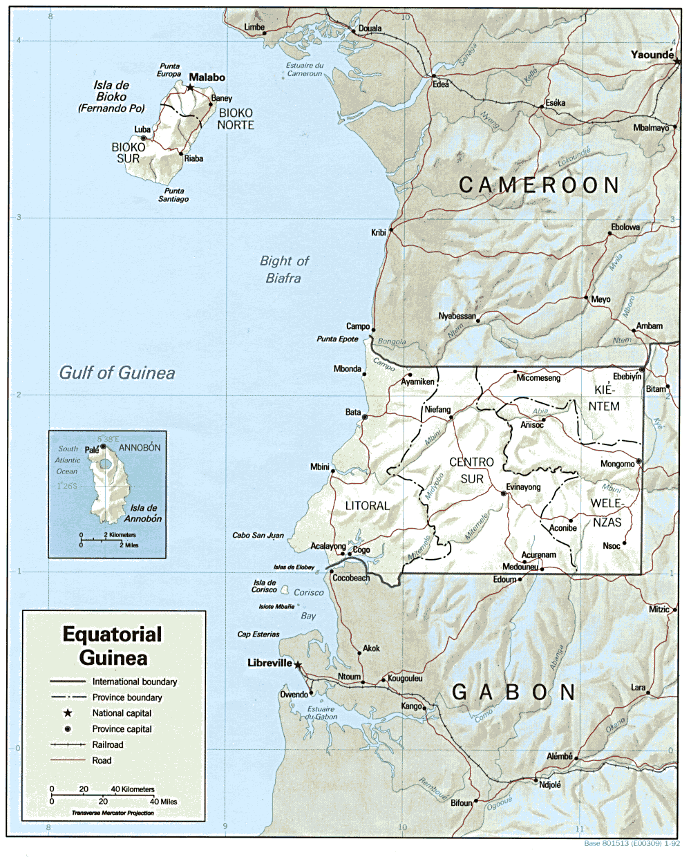
| Nkówá | Shaded relief map of Equatorial Guinea. | |||
| Ǹgụ́ụ̀bọ̀chị̀ | ||||
| Mkpọlọ́gwụ̀ | [1] from the Perry-Castañeda Library Map Collection. | |||
| Odé ákwụ́kwọ́ | CIA | |||
| Ọdà (Í jí kwá usòrò nke) |
|

![[1]](http://www.lib.utexas.edu/maps/africa/equatorial_guinea.gif)
Ịta nke usòrò
Bìri èhì/ogè k'ị hụ òtù ụ̀fa dị̀ m̀gbè ahụ̀.
| Èhì/Ogè | Mbọ-aka | Ógólógó na asaá | Òjìème | Nkwute | |
|---|---|---|---|---|---|
| dị ùgbu â | 11:00, 22 Febụwarị 2006 | | 1,000 × 1,240 (264 KB) | Lupo | Shaded relief map of Equatorial Guinea. Source: [http://www.lib.utexas.edu/maps/africa/equatorial_guinea.gif] from the [http://www.lib.utexas.edu/maps/equatorial_guinea.html Perry-Castañeda Library Map Collection]. {{PD-USGov-CIA}} [[Category:Maps |
Ojiji faịlụ
Ihe ndị na-eso ihe eji Ihu akwụkwọ eme na faịlụ a:
Ejiji failụ zụrụ ọha
Wikis ndi a edeputara na eji kwa failụ a:
- Ihe eji na ca.wikipedia.org
- Ihe eji na cs.wikipedia.org
- Ihe eji na el.wikipedia.org
- Ihe eji na en.wikipedia.org
- Ihe eji na en.wikiversity.org
- Ihe eji na es.wikipedia.org
- Ihe eji na fa.wikipedia.org
- Ihe eji na ff.wikipedia.org
- Ihe eji na fr.wikipedia.org
- Ihe eji na ha.wikipedia.org
- Ihe eji na hr.wiktionary.org
- Ihe eji na hu.wiktionary.org
- Ihe eji na id.wikipedia.org
- Ihe eji na it.wikipedia.org
- Ihe eji na ja.wikipedia.org
- Ihe eji na ka.wikipedia.org
- Ihe eji na lt.wikipedia.org
- Ihe eji na mdf.wikipedia.org
- Ihe eji na no.wikipedia.org
- Ihe eji na pt.wikipedia.org
- Ihe eji na si.wikipedia.org
- Ihe eji na sr.wikipedia.org
- Ihe eji na tum.wikipedia.org
- Ihe eji na uk.wikipedia.org
- Ihe eji na vec.wikipedia.org
- Ihe eji na vi.wikipedia.org
- Ihe eji na zh.wikipedia.org