Usòrò:EU-Croatia.svg

Size of this PNG preview of this SVG file: 713 × 600 piksels. Ndị ọzọ mkpebi:285 × 240 piksels | 571 × 480 piksels | 913 × 768 piksels | 1,218 × 1,024 piksels | 2,435 × 2,048 piksels | 2,045 × 1,720 piksels.
Failụ si na nke mbu (usòrò SVG, nà áhà pixel 2,045 × 1,720, ívụ usòrò: 7.33 MB)
Mmẹkụwátá
| Nkówá |
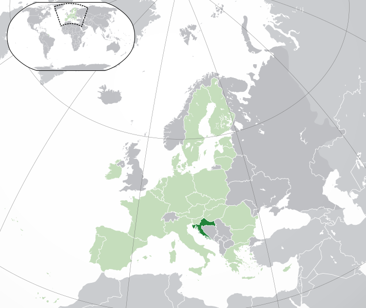
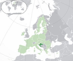
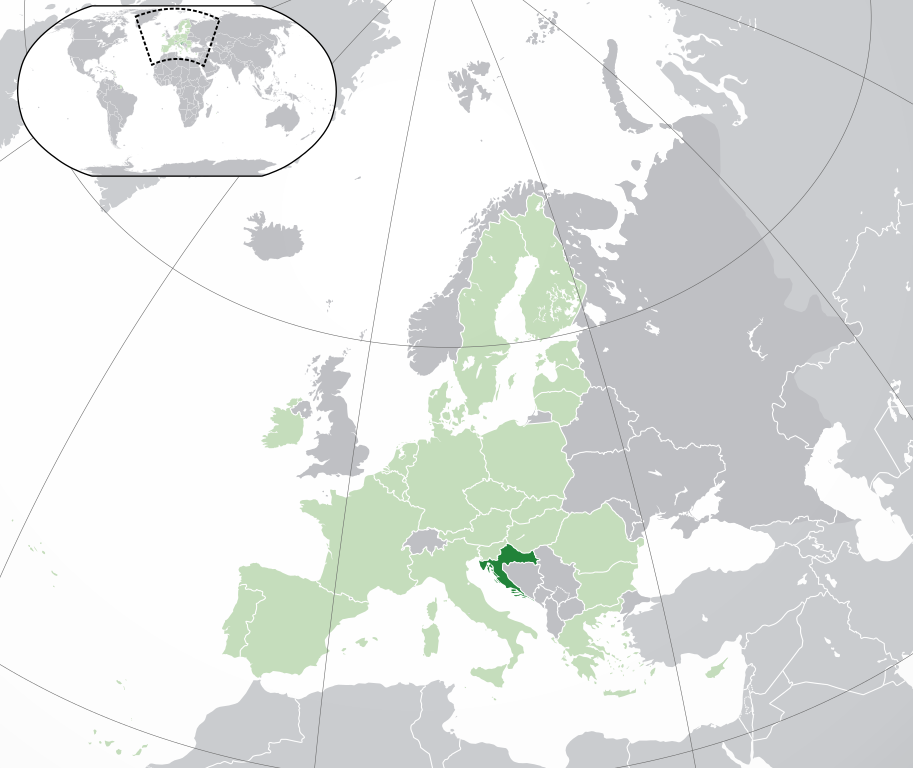
Français : (Vert) Croatie
(Vert clair) : Union Européenne (UE) (Gris) : Europe (Gris clair) : Région avoisinanteEnglish: (Green) : Croatia
(Light-green) : The European Union (EU) (Grey) : Europe (Light grey) : The surrounding region. |
| Ǹgụ́ụ̀bọ̀chị̀ | |
| Mkpọlọ́gwụ̀ | Orü ọnwé |
| Odé ákwụ́kwọ́ | {{Atoine85}} |
| Nke ya ozor |
|
| SVG genesis |


Nkwényé
I, the copyright holder of this work, hereby publish it under the following license:
Edebere faịlụ a n'okpuru ikikeree Creative Commons Attribution-Share Alike 3.0 Unported license.
- I wepulara nóru:
- i nye – ikọpị,ikekasi na izịpụ ọru a
- i dowaria – igbanwee ọrụ a
- Ọ ga bụ na ọnọdụ ndi a:
- í-kpó-áhà – Ị ga-enyerịrị ugo kwesịrị ekwesị, nye njikọ na ikikere ahụ, ma gosikwa ma emere mgbanwe. Ị nwere ike ime ya n'ụzọ ezi uche ọ bụla, mana ọ bụghị n'ụzọ ọ bụla na-egosi na onye nyere ikikere kwadoro gị maọbụ ojiji gị.
- gbásàa kà – Ọ bụrụ na ị tụgharịgharịa, gbanwee, ma ọ bụ wulite n'elu ihe ahụ, ị ga-ekesa ndenye gị n'okpuru otu ma ọ bụ ikike dakọtara dị ka nke mbụ.
Ịta nke usòrò
Bìri èhì/ogè k'ị hụ òtù ụ̀fa dị̀ m̀gbè ahụ̀.
| Èhì/Ogè | Mbọ-aka | Ógólógó na asaá | Òjìème | Nkwute | |
|---|---|---|---|---|---|
| dị ùgbu â | 04:43, 1 Febụwarị 2020 | | 2,045 × 1,720 (7.33 MB) | Rob984 | UK and Gibraltar have left the EU. New base which includes all of Portugal's islands within frame, as well as Arctic Russian islands part of Europe. Also fixed Flevoland in the Netherlands. |
| 16:54, 25 Ọktoba 2016 |  | 2,045 × 1,720 (7.32 MB) | Giorgi Balakhadze | fix | |
| 16:37, 25 Ọktoba 2016 |  | 2,045 × 1,720 (7.33 MB) | Giorgi Balakhadze | Rv of sockpuppet and per COM:OVERWRITE | |
| 16:26, 18 Maachị 2015 |  | 2,045 × 1,720 (7.38 MB) | Mapclean | Reverted to Leftcry's version, please go to your talk page | |
| 14:03, 21 Febụwarị 2015 |  | 2,044 × 1,719 (2.03 MB) | VS6507 | Spain. Greece. Slovakia. Cyprus. Romania VETO | |
| 19:35, 16 Novemba 2014 |  | 2,045 × 1,720 (7.38 MB) | Leftcry | Reverted to version as of 22:33, 18 October 2014 Please go to your talk page | |
| 16:21, 16 Novemba 2014 |  | 2,044 × 1,719 (2.03 MB) | A2D2 | The map must show the original de-jure status with no breakaway regions, as it was originally created. An alternative map showing the de-facto status with breakaway regions needs to created instead. | |
| 15:42, 16 Novemba 2014 |  | 2,045 × 1,720 (7.38 MB) | A2D2 | Reverted to version as of 12:10, 16 August 2014 | |
| 22:33, 18 Ọktoba 2014 |  | 2,045 × 1,720 (7.38 MB) | Leftcry | Minor fix | |
| 12:10, 16 Ọgọọst 2014 |  | 2,045 × 1,720 (7.38 MB) | DIREKTOR | Fixed overview. |
Ojiji faịlụ
Ihe ndị na-eso ihe eji Ihu akwụkwọ eme na faịlụ a:
Ejiji failụ zụrụ ọha
Wikis ndi a edeputara na eji kwa failụ a:
- Ihe eji na ace.wikipedia.org
- Ihe eji na ady.wikipedia.org
- Ihe eji na af.wikipedia.org
- Ihe eji na ami.wikipedia.org
- Ihe eji na ar.wikipedia.org
- كرواتيا
- مستخدم:ElWaliElAlaoui/ملعب 8
- معاملة المثليين في كرواتيا
- مستخدم:جار الله/قائمة صور مقالات العلاقات الثنائية
- العلاقات الأمريكية الكرواتية
- العلاقات الأنغولية الكرواتية
- العلاقات الكرواتية الكورية الجنوبية
- العلاقات الإريترية الكرواتية
- العلاقات السويسرية الكرواتية
- العلاقات الألمانية الكرواتية
- العلاقات الكرواتية الليختنشتانية
- العلاقات البوليفية الكرواتية
- العلاقات الكرواتية الموزمبيقية
- العلاقات الألبانية الكرواتية
- العلاقات البلجيكية الكرواتية
- العلاقات الإثيوبية الكرواتية
- العلاقات البيلاروسية الكرواتية
- العلاقات الطاجيكستانية الكرواتية
- العلاقات الروسية الكرواتية
- العلاقات الرومانية الكرواتية
- العلاقات الأرجنتينية الكرواتية
- العلاقات الغامبية الكرواتية
- العلاقات القبرصية الكرواتية
- العلاقات السيراليونية الكرواتية
- العلاقات الكرواتية النيبالية
- العلاقات الكرواتية الليبيرية
- العلاقات التشيكية الكرواتية
- العلاقات الكرواتية الميانمارية
- العلاقات الكرواتية الكندية
- العلاقات الزيمبابوية الكرواتية
- العلاقات الإسرائيلية الكرواتية
- العلاقات البالاوية الكرواتية
- العلاقات الكرواتية المالية
- العلاقات الكرواتية النيجيرية
- العلاقات اليمنية الكرواتية
- العلاقات الفانواتية الكرواتية
- العلاقات الغابونية الكرواتية
- العلاقات البنمية الكرواتية
- العلاقات الكرواتية الكوبية
- العلاقات الجورجية الكرواتية
- العلاقات الكرواتية الكورية الشمالية
- العلاقات الهندية الكرواتية
- العلاقات اليابانية الكرواتية
- العلاقات الإيطالية الكرواتية
- العلاقات الكرواتية الناوروية
- العلاقات الأسترالية الكرواتية
Lee more global usage of this file.