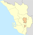
Usòrò:Klang valley map.svg

Size of this PNG preview of this SVG file: 409 × 440 piksels. Ndị ọzọ mkpebi:223 × 240 piksels | 446 × 480 piksels | 714 × 768 piksels | 952 × 1,024 piksels | 1,904 × 2,048 piksels.
Failụ si na nke mbu (usòrò SVG, nà áhà pixel 409 × 440, ívụ usòrò: 28 KB)
Ịta nke usòrò
Bìri èhì/ogè k'ị hụ òtù ụ̀fa dị̀ m̀gbè ahụ̀.
| Èhì/Ogè | Mbọ-aka | Ógólógó na asaá | Òjìème | Nkwute | |
|---|---|---|---|---|---|
| dị ùgbu â | 11:20, 25 Septemba 2022 |  | 409 × 440 (28 KB) | PenangLion | Uploaded own work with UploadWizard |
Ojiji faịlụ
Ọdighi ihuakwụkwọ nwere failụ a.
Ejiji failụ zụrụ ọha
Wikis ndi a edeputara na eji kwa failụ a:
- Ihe eji na en.wikipedia.org
- Kuala Lumpur International Airport
- Batu Caves
- Shah Alam
- Bangsar
- Sultan Abdul Aziz Shah Airport
- Klang (city)
- Petaling Jaya
- Subang Jaya
- Kuala Selangor
- Hulu Selangor District
- Rawang, Selangor
- Sungai Buloh
- Darul Ehsan Mosque
- Alaeddin Mosque (Jugra, Malaysia)
- Raja Alang Mosque
- Serendah
- Bukit Beruntung
- Pulau Indah
- Ulu Kelang
- Taman Hillview
- Sekinchan
- Batu Arang
- Tanjong Karang, Selangor
- Al-Falah Mosque, Selangor
- Puchong Perdana Mosque
- Taman Greenwood
- Al-Amaniah Mosque
- Taman Keramat
- Tasik Biru Seri Kundang
- Kajang Prison
- Elmina, Malaysia
- User:Fire Law Stone
- Football at the 2017 SEA Games
- Kwasa Damansara
- SS2, Petaling Jaya
- Sungai Buloh Hospital
- 2018 AFC U-16 Championship
- Wikipedia:Meetup/Selangor
- Module:Location map/data/Malaysia Selangor
- Module:Location map/data/Malaysia Selangor/doc
- Bukit Kutu
- Wikipedia:WikiProject Articles for creation/Help desk/Archives/2021 September 16
- User:PenangLion/sandbox
- Serenia City
- Ihe eji na id.wikipedia.org
- Ihe eji na ms.wikipedia.org
- Ihe eji na si.wikipedia.org