Faịlụ:Map of South Africa with Fezile Dabi highlighted (2011).svg

Size of this PNG preview of this SVG file: 684 × 599 piksels. Ndị ọzọ mkpebi:274 × 240 piksels | 548 × 480 piksels | 876 × 768 piksels | 1,168 × 1,024 piksels | 2,337 × 2,048 piksels | 809 × 709 piksels.
Failụ si na nke mbu (usòrò SVG, nà áhà pixel 809 × 709, ívụ usòrò: 496 KB)
Ịta nke usòrò
Bìri èhì/ogè k'ị hụ òtù ụ̀fa dị̀ m̀gbè ahụ̀.
| Èhì/Ogè | Mbọ-aka | Ógólógó na asaá | Òjìème | Nkwute | |
|---|---|---|---|---|---|
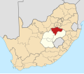
| dị ùgbu â | 19:25, 2 Mee 2011 |  | 809 × 709 (496 KB) | Htonl | == Summary == {{Information |Description ={{en|1=Map of district boundaries in South Africa, as they will be after the municipal elections of 18 May 2011, with the w:Fezile Dabi District Municipality hi |
Ojiji faịlụ
Ihe ndị na-eso ihe eji Ihu akwụkwọ eme na faịlụ a:
Ejiji failụ zụrụ ọha
Wikis ndi a edeputara na eji kwa failụ a:
- Ihe eji na af.wikipedia.org
- Kroonstad
- Sasolburg
- Parys, Vrystaat
- Frankfort
- Villiers
- Cornelia
- Tweeling, Vrystaat
- Vredefort
- Heilbron
- Oranjeville
- Edenville
- Koppies
- Steynsrus
- Viljoenskroon
- Deneysville
- Vierfontein
- Viljoensdrif
- Sjabloonbespreking:Suid-Afrikaanse distriksmunisipaliteit navbox
- Holly Country
- Kragbron
- Rietfontein, Vrystaat
- Matlwangtlwang
- Rammulotsi
- Maokeng
- Schonkenville
- Tumahole
- Mokwallo
- Sandersville
- Phiritona
- Ngwathe
- Kwakwatsi
- Namahadi
- Mafahlaneng
- Qalabotjha
- Ntswanatsatsi
- Refengkgotso
- Zamdela
- Liliandale
- Richmond, Vrystaat
- Ihe eji na en.wikipedia.org
Lee more global usage of this file.
