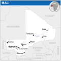
Faịlụ:Mali - Location Map (2013) - MLI - UNOCHA.svg

Size of this PNG preview of this SVG file: 254 × 254 piksels. Ndị ọzọ mkpebi:240 × 240 piksels | 480 × 480 piksels | 768 × 768 piksels | 1,024 × 1,024 piksels | 2,048 × 2,048 piksels.
Failụ si na nke mbu (usòrò SVG, nà áhà pixel 254 × 254, ívụ usòrò: 407 KB)
Ịta nke usòrò
Bìri èhì/ogè k'ị hụ òtù ụ̀fa dị̀ m̀gbè ahụ̀.
| Èhì/Ogè | Mbọ-aka | Ógólógó na asaá | Òjìème | Nkwute | |
|---|---|---|---|---|---|
| dị ùgbu â | 01:46, 29 Maachị 2015 |  | 254 × 254 (407 KB) | Pharos | update |
| 03:31, 18 Novemba 2014 |  | 254 × 254 (407 KB) | Pharos | try without logo for now | |
| 23:52, 7 Mee 2014 |  | 254 × 254 (376 KB) | UN OCHA maps bot | == {{int:filedesc}} == {{Information |description={{en|1=Locator map of Mali.}} |date=2013 |source={{en|1=[http://reliefweb.int/map/mali/mali-location-map-2013 Mali Locator Map (ReliefWeb)]}} |author={{en|1=[[w:en:United Nations Office fo... |
Ojiji faịlụ
Ihe ndị na-eso ihe eji Ihu akwụkwọ eme na faịlụ a:
Ejiji failụ zụrụ ọha
Wikis ndi a edeputara na eji kwa failụ a:
- Ihe eji na arz.wikipedia.org
- Ihe eji na ast.wikipedia.org
- Ihe eji na azb.wikipedia.org
- Ihe eji na bh.wikipedia.org
- Ihe eji na bn.wikipedia.org
- Ihe eji na ca.wikipedia.org
- Ihe eji na dag.wikipedia.org
- Ihe eji na de.wikivoyage.org
- Ihe eji na dga.wikipedia.org
- Ihe eji na diq.wikipedia.org
- Ihe eji na dty.wikipedia.org
- Ihe eji na eo.wikinews.org
- Ihe eji na ff.wikipedia.org
- Ihe eji na fi.wikipedia.org
- Ihe eji na fr.wikinews.org
- Ihe eji na fr.wikivoyage.org
- Ihe eji na ga.wikipedia.org
- Ihe eji na gd.wikipedia.org
- Ihe eji na gl.wikipedia.org
- Ihe eji na gpe.wikipedia.org
- Ihe eji na gu.wikipedia.org
- Ihe eji na ha.wikipedia.org
- Ihe eji na he.wikivoyage.org
- Ihe eji na hi.wikipedia.org
- Ihe eji na ht.wikipedia.org
- Ihe eji na ia.wikipedia.org
- Ihe eji na id.wikipedia.org
- Ihe eji na ilo.wikipedia.org
- Ihe eji na incubator.wikimedia.org
- Ihe eji na it.wikipedia.org
- Ihe eji na kab.wikipedia.org
- Ihe eji na mg.wikipedia.org
- Ihe eji na mt.wikipedia.org
- Ihe eji na ne.wikipedia.org
- Ihe eji na nqo.wikipedia.org
- Ihe eji na pap.wikipedia.org
- Ihe eji na pl.wikipedia.org
- Ihe eji na rw.wikipedia.org
- Ihe eji na sco.wikipedia.org
- Ihe eji na sd.wikipedia.org
- Ihe eji na te.wikipedia.org
- Ihe eji na tl.wikipedia.org
- Ihe eji na tt.wikipedia.org
Lee more global usage of this file.
