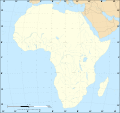
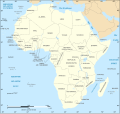
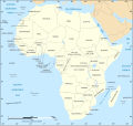
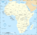
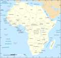
Faịlụ:African continent-en.svg

Size of this PNG preview of this SVG file: 635 × 600 piksels. Ndị ọzọ mkpebi:254 × 240 piksels | 508 × 480 piksels | 813 × 768 piksels | 1,084 × 1,024 piksels | 2,169 × 2,048 piksels | 1,525 × 1,440 piksels.
Failụ si na nke mbu (usòrò SVG, nà áhà pixel 1,525 × 1,440, ívụ usòrò: 752 KB)
Ịta nke usòrò
Bìri èhì/ogè k'ị hụ òtù ụ̀fa dị̀ m̀gbè ahụ̀.
| Èhì/Ogè | Mbọ-aka | Ógólógó na asaá | Òjìème | Nkwute | |
|---|---|---|---|---|---|
| dị ùgbu â | 18:21, 6 Disemba 2020 |  | 1,525 × 1,440 (752 KB) | Sting | Swatziland => eSwatini |
| 19:59, 14 Julaị 2011 |  | 1,525 × 1,440 (752 KB) | Sting | Sudan/South Sudan 2011-07 border update | |
| 16:42, 16 Disemba 2010 |  | 1,525 × 1,440 (747 KB) | Sting | Spelling correction: Madeira | |
| 20:16, 10 Jenụwarị 2009 |  | 1,525 × 1,440 (747 KB) | Sting | Correction Sao Tome | |
| 08:37, 6 Disemba 2008 |  | 1,525 × 1,440 (750 KB) | Bobarino | {{Information |Description={{en|Map of the African continent.}} {{fr|Carte vierge du continent africain.}} Lambert azimutal equal-area projection, WGS84 datum, standard meridian: 15°E, standard pa |
Ojiji faịlụ
Ihe ndị na-eso ihe eji Ihu akwụkwọ eme na faịlụ a:
Ejiji failụ zụrụ ọha
Wikis ndi a edeputara na eji kwa failụ a:
- Ihe eji na af.wikipedia.org
- Ihe eji na ar.wikipedia.org
- Ihe eji na azb.wikipedia.org
- Ihe eji na az.wiktionary.org
- Ihe eji na de.wikipedia.org
- Ihe eji na en.wikipedia.org
- Ihe eji na fa.wikipedia.org
- Ihe eji na hi.wikipedia.org
- Ihe eji na hu.wikibooks.org
- Ihe eji na id.wikipedia.org
- Ihe eji na ilo.wikipedia.org
- Ihe eji na ja.wikipedia.org
- Ihe eji na ko.wikipedia.org
- Ihe eji na www.mediawiki.org
- Ihe eji na ml.wikipedia.org
- Ihe eji na mn.wikipedia.org
- Ihe eji na nl.wikipedia.org
- Ihe eji na simple.wikipedia.org
- Ihe eji na sw.wikipedia.org
- Ihe eji na te.wikipedia.org
- Ihe eji na th.wikipedia.org
- Ihe eji na tly.wikipedia.org
- Ihe eji na tr.wikipedia.org
- Ihe eji na uz.wikipedia.org
- Ihe eji na yo.wikipedia.org
