Faịlụ:Abies beshanzuensis distribution map.svg

Failụ si na nke mbu (usòrò SVG, nà áhà pixel 1,241 × 1,177, ívụ usòrò: 1.22 MB)

Failụ a si na Wikimedia Commons,enwekwara ike iji ya eme ihe na arụmarụ ọzọ. Nkọwa na ihuakwukwọ nkọwa failụ eziri na okpuru.

Mmẹkụwátá

Nkówá
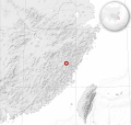
English: Baishanzu Fir (Abies beshanzuensis) distribution map.

Cartographic data :

  • Lambert azimuthal equal-area projection
  • Limits of the map : N 32.32, W 113, S 21.82, E 125
Français : Aire de répartition du Sapin du Baishanzu.

Données cartographiques :

  • Projection azimutale équivalente de Lambert
  • Limites de la carte : N 32.32, O 113, S 21.82, E 125
Ǹgụ́ụ̀bọ̀chị̀
Mkpọlọ́gwụ̀
English:
Français :
  • Données de répartition : liste rouge des espèces les plus menacées, de l'Union internationale pour la conservation de la nature
  • Côtes, lacs, rivières, frontières : NGDC GSHHS
  • Relief : Centre de données géophysiques nationales (NGDC) ETOPO1
  • Globe : People's_Republic_of_China_(orthographic_projection).svg: Ssolbergj (talk)
  • Odé ákwụ́kwọ́
    • Map: Sémhur
    • UICN Assessors: Conifer Specialist Group
    SVG genesis
    InfoField
     
    The SVG code is valid.
     
    This map was created with Inkscape…important.
     
      This SVG map uses embedded raster graphics to show its topographic structures.
    Í-kpó-áhà
    (required by the license)
    InfoField
    © Sémhur / Wikimedia Commons / 
    © Sémhur / Wikimedia Commons
    Camera location29° 00′ 00″ N, 119° 00′ 00″ E Kartographer map based on OpenStreetMap.View this and other nearby images on: OpenStreetMapinfo

    Nkwényé

    The use of spatial data from the IUCN Red List web site to produce species distribution maps is subject to the Attribution-Share Alike Creative Commons License. In short: you are free to distribute and modify the file as long as you attribute its authors and the IUCN Red List.

    العربيَّة | English | español | français | македонски | മലയാളം | português | +/−

    w:en:Creative Commons
    í-kpó-áhà gbásàa kà
    Edebere faịlụ a n'okpuru ikikeree Creative Commons Attribution-Share Alike 3.0 Unported license.
    Í-kpó-áhà: IUCN Red List of Threatened Species, species assessors and the authors of the spatial data.
    I wepulara nóru:
    • i nye – ikọpị,ikekasi na izịpụ ọru a
    • i dowaria – igbanwee ọrụ a
    Ọ ga bụ na ọnọdụ ndi a:
    • í-kpó-áhà – Ị ga-enyerịrị ugo kwesịrị ekwesị, nye njikọ na ikikere ahụ, ma gosikwa ma emere mgbanwe. Ị nwere ike ime ya n'ụzọ ezi uche ọ bụla, mana ọ bụghị n'ụzọ ọ bụla na-egosi na onye nyere ikikere kwadoro gị maọbụ ojiji gị.
    • gbásàa kà – Ọ bụrụ na ị tụgharịgharịa, gbanwee, ma ọ bụ wulite n'elu ihe ahụ, ị ga-ekesa ndenye gị n'okpuru otu ma ọ bụ ikike dakọtara dị ka nke mbụ.

    I, the copyright holder of this work, hereby publish it under the following licenses:
    Licence Art Libre Copyleft: This work of art is free; you can redistribute it and/or modify it according to terms of the Free Art License. You will find a specimen of this license on the Copyleft Attitude site as well as on other sites.
    w:en:Creative Commons
    í-kpó-áhà gbásàa kà
    This file is licensed under the Creative Commons Attribution-Share Alike 4.0 International, 3.0 Unported, 2.5 Generic, 2.0 Generic and 1.0 Generic license.
    I wepulara nóru:
    • i nye – ikọpị,ikekasi na izịpụ ọru a
    • i dowaria – igbanwee ọrụ a
    Ọ ga bụ na ọnọdụ ndi a:
    • í-kpó-áhà – Ị ga-enyerịrị ugo kwesịrị ekwesị, nye njikọ na ikikere ahụ, ma gosikwa ma emere mgbanwe. Ị nwere ike ime ya n'ụzọ ezi uche ọ bụla, mana ọ bụghị n'ụzọ ọ bụla na-egosi na onye nyere ikikere kwadoro gị maọbụ ojiji gị.
    • gbásàa kà – Ọ bụrụ na ị tụgharịgharịa, gbanwee, ma ọ bụ wulite n'elu ihe ahụ, ị ga-ekesa ndenye gị n'okpuru otu ma ọ bụ ikike dakọtara dị ka nke mbụ.
    Ị nwere ike họrọ ikikere nke masịrị gị.

    Nkowapụta

    Tinye nkọwa otu ahịrị ihe faịlụ a na-anochi anya ya.

    Ihe ndị egosiri na faịlụ a

    depicts Bekee

    6 Ọktoba 2012

    29°N, 119°E

    image/svg+xml

    checksum Bekee

    2b30c1a414b80aa8a1f0cd97771ab3ffc74b0bfd

    data size Bekee

    1,279,951 byte

    1,177 pixel

    width Bekee

    1,241 pixel

    Ịta nke usòrò

    Bìri èhì/ogè k'ị hụ òtù ụ̀fa dị̀ m̀gbè ahụ̀.

    Èhì/OgèMbọ-akaÓgólógó na asaáÒjìèmeNkwute
    dị ùgbu â19:19, 24 Eprel 2014NvóÁká màkà otù ȯ dị nà 19:19, 24 Eprel 20141,241 × 1,177 (1.22 MB)SémhurValid SVG
    12:35, 8 Ọktoba 2012NvóÁká màkà otù ȯ dị nà 12:35, 8 Ọktoba 20121,241 × 1,177 (1.32 MB)Sémhurgood size
    15:48, 6 Ọktoba 2012NvóÁká màkà otù ȯ dị nà 15:48, 6 Ọktoba 2012512 × 486 (1.32 MB)Sémhurrelief 66,7% opacity
    15:40, 6 Ọktoba 2012NvóÁká màkà otù ȯ dị nà 15:40, 6 Ọktoba 2012512 × 486 (1.32 MB)Sémhur== {{int:filedesc}} == {{Information |Description={{Multilingual description |en= Pine of Baishanzu (''Abies_beshanzuensis'') distribution map.<br> Cartographic data : * Lambert azimuthal equal-area projection * Limits of th...

    Ihe ndị na-eso ihe eji Ihu akwụkwọ eme na faịlụ a:

    Ejiji failụ zụrụ ọha

    Wikis ndi a edeputara na eji kwa failụ a:

    Ómárí nso