Usòrò:Looking northwest from Hamlin Peak.jpg

Otu nyochaa a ha:800 × 600 piksels Ndị ọzọ mkpebi:320 × 240 piksels | 640 × 480 piksels | 1,024 × 768 piksels | 1,280 × 960 piksels | 2,560 × 1,920 piksels | 2,816 × 2,112 piksels.
Failụ si na nke mbu (2,816 × 2,112 pixel, ívù akwukwo orunótu: 1.75 MB, MIME nke: image/jpeg)
Mmẹkụwátá
| Nkówá |
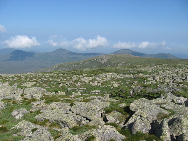
English: Looking northwest from Hamlin Peak of Mount Katahdin in Baxter State Park, Maine |
| Ǹgụ́ụ̀bọ̀chị̀ | |
| Mkpọlọ́gwụ̀ | Orü ọnwé |
| Odé ákwụ́kwọ́ | Fredlyfish4 |
| Camera location | | View this and other nearby images on: OpenStreetMap |
|---|
Nkwényé
I, the copyright holder of this work, hereby publish it under the following licenses:
Edebere faịlụ a n'okpuru ikikeree Creative Commons Attribution-Share Alike 3.0 Unported license.
- I wepulara nóru:
- i nye – ikọpị,ikekasi na izịpụ ọru a
- i dowaria – igbanwee ọrụ a
- Ọ ga bụ na ọnọdụ ndi a:
- í-kpó-áhà – Ị ga-enyerịrị ugo kwesịrị ekwesị, nye njikọ na ikikere ahụ, ma gosikwa ma emere mgbanwe. Ị nwere ike ime ya n'ụzọ ezi uche ọ bụla, mana ọ bụghị n'ụzọ ọ bụla na-egosi na onye nyere ikikere kwadoro gị maọbụ ojiji gị.
- gbásàa kà – Ọ bụrụ na ị tụgharịgharịa, gbanwee, ma ọ bụ wulite n'elu ihe ahụ, ị ga-ekesa ndenye gị n'okpuru otu ma ọ bụ ikike dakọtara dị ka nke mbụ.

|
Í nwèrèíkí jé, gbạsáa na/ma í mezí akwukwo nka na okpúrù íwú GNU Ákwúkwó Íwú nke Owéré, Nké 1.2 ma nke íchè ndi Free Software Foundation; wéfùtàrà; na adighi nkejị di íchẹ, adighi édé nke Ihú-Ihü Ákwúkwó, na adighi Ázú-Ihü Ákwúkwó. Ákwúkwó iwu hé jéré jé di na nkeji kpóró GNU Ákwúkwó Íwú nke Owéré". |
Ị nwere ike họrọ ikikere nke masịrị gị.
| File created by Fredlyfish4 | |
| Permission is granted for use under CC BY-SA 4.0 (or a similar license) for this file created by the author.
Please let the author know if you use this work outside of Wikimedia projects by sending an email to
|
Ịta nke usòrò
Bìri èhì/ogè k'ị hụ òtù ụ̀fa dị̀ m̀gbè ahụ̀.
| Èhì/Ogè | Mbọ-aka | Ógólógó na asaá | Òjìème | Nkwute | |
|---|---|---|---|---|---|
| dị ùgbu â | 21:45, 22 Novemba 2010 | | 2,816 × 2,112 (1.75 MB) | Fredlyfish4 | {{Information |Description={{en|1=Looking northwest from Hamlin Peak of Mount Katahdin in Baxter State Park, Maine}} |Source={{own}} |Author=Fredlyfish4 |Date=2010-06-25 |Permission= |other_versions= }} Category:Mountains [[Categ |
Ojiji faịlụ
Ihe ndị na-eso ihe eji Ihu akwụkwọ eme na faịlụ a:
Ejiji failụ zụrụ ọha
Wikis ndi a edeputara na eji kwa failụ a:
- Ihe eji na de.wikipedia.org
- Ihe eji na en.wikipedia.org
- Ihe eji na rm.wikipedia.org