Usòrò:CHN orthographic.svg

Size of this PNG preview of this SVG file: 550 × 550 piksels. Ndị ọzọ mkpebi:240 × 240 piksels | 480 × 480 piksels | 768 × 768 piksels | 1,024 × 1,024 piksels | 2,048 × 2,048 piksels.
Failụ si na nke mbu (usòrò SVG, nà áhà pixel 550 × 550, ívụ usòrò: 1.46 MB)
Mmẹkụwátá
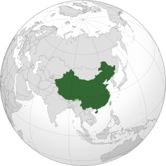
| Nkówá | China orthographic map |
| Ǹgụ́ụ̀bọ̀chị̀ |
|
| Mkpọlọ́gwụ̀ |
Orü ọnwé |
| Odé ákwụ́kwọ́ |
Addicted04 |
.svg)
.svg)
.svg)
.svg)
.svg)
.svg)
.svg)
.svg)
.svg)
.svg)
.svg)
.svg)
.svg)
.svg)
.svg)
.svg)
.svg)
.svg)
.svg)
.svg)
.svg)
.svg)
.svg)
.svg)
.svg)
.svg)
.svg)
.svg)
.svg)
.svg)
.svg)
.svg)
.svg)
.svg)
.svg)
.svg)
.svg)
.svg)
.svg)
.svg)
.svg)
.svg)
.svg)
.svg)
.svg)
.svg)
.svg)
.svg)
.svg)
.svg)
.svg)
.svg)
.svg)
.svg)
.svg)
.svg)
.svg)
.svg)
.svg)
.svg)
.svg)
.svg)
.svg)
.svg)
.svg)
.svg)
.svg)
.svg)
.svg)
.svg)
.svg)
.svg)
.svg)
.svg)

.svg)

.svg)

.svg)
.svg)
.svg)
.svg)
.svg)
.svg)
.svg)


.svg)
.svg)
.svg)
.svg)
.svg)
.svg)
.svg)

.svg)
.svg)
.svg)
.svg)
.svg)
.svg)
.svg)
.svg)
.svg)

.svg)
.svg)
.svg)
.svg)
.svg)
.svg)
.svg)
_without_national_boundaries.svg)
.svg)
.svg)
.svg)
.svg)
.svg)
.svg)

.svg)
.svg)
.png)
.svg)
.svg)
.svg)
.svg)

.svg)
.svg)
.svg)
.svg)
.svg)
.svg)
.svg)
.svg)
.svg)
.svg)
.svg)

.svg)
.svg)
.svg)
.svg)
.svg)
.svg)
.svg)
.svg)
.svg)

.svg)
.svg)

.svg)
.svg)
.svg)
.svg)
.svg)
.svg)
.svg)
.svg)
.svg)
.svg)
.svg)
.svg)
.svg)
.svg)
.svg)
.svg)
.svg)
.svg)
.svg)
.svg)
.svg)
.svg)
.svg)
.svg)
.svg)
.svg)
.svg)
_-_Crimea_disputed.svg)
.svg)
.svg)
.svg)
.svg)
.svg)
.svg)
.svg)
.svg)
.svg)
.svg)
.svg)
_political.svg)
.svg)
.svg)
.svg)
.svg)
_-_Crimea_disputed_-_no_borders.svg)
.svg)
.svg)
.svg)
.svg)
.svg)
.svg)
.svg)
.svg)
.svg)
.svg)
.svg)

.svg)
.svg)
.svg)

.png)
.svg)
.svg)
.svg)
.svg)
.svg)
.svg)
.svg)
.svg)
.svg)
.svg)
.svg)
.svg)
.svg)
.svg)
.svg)
.svg)
.svg)
.svg)
.svg)
.svg)
.svg)
.svg)
.svg)
.svg)
.svg)
.svg)
.svg)
.svg)
.svg)
.svg)
.svg)
.svg)
.svg)
.svg)
.png)
.svg)
.svg)
.svg)
_(orthographic_projection).png)
| Orthographic projections maps created by Ssolbergj |
|---|
| Orthographic projections maps created by Ssolbergj: |
.svg)
.svg)
| Annotations | This image is annotated: View the annotations at Commons |
Nkwényé
I, the copyright holder of this work, hereby publish it under the following license:
Edebere faịlụ a n'okpuru ikikeree Creative Commons Attribution-Share Alike 3.0 Unported license.
- I wepulara nóru:
- i nye – ikọpị,ikekasi na izịpụ ọru a
- i dowaria – igbanwee ọrụ a
- Ọ ga bụ na ọnọdụ ndi a:
- í-kpó-áhà – Ị ga-enyerịrị ugo kwesịrị ekwesị, nye njikọ na ikikere ahụ, ma gosikwa ma emere mgbanwe. Ị nwere ike ime ya n'ụzọ ezi uche ọ bụla, mana ọ bụghị n'ụzọ ọ bụla na-egosi na onye nyere ikikere kwadoro gị maọbụ ojiji gị.
- gbásàa kà – Ọ bụrụ na ị tụgharịgharịa, gbanwee, ma ọ bụ wulite n'elu ihe ahụ, ị ga-ekesa ndenye gị n'okpuru otu ma ọ bụ ikike dakọtara dị ka nke mbụ.

|
WARNING! According to Chinese Law, producing, selling and advertising maps or other items, both in electronic and print versions, that do not conform to the territorial claims of the Chinese government is prohibited. |
Ịta nke usòrò
Bìri èhì/ogè k'ị hụ òtù ụ̀fa dị̀ m̀gbè ahụ̀.
| Èhì/Ogè | Mbọ-aka | Ógólógó na asaá | Òjìème | Nkwute | |
|---|---|---|---|---|---|
| dị ùgbu â | 06:04, 11 Febụwarị 2020 | | 550 × 550 (1.46 MB) | 芄蘭 | Reverted to version as of 14:28, 31 July 2019 (UTC) |
| 13:02, 10 Febụwarị 2020 |  | 720 × 722 (334 KB) | Abhishek65628 | Reverted to version as of 15:44, 25 July 2019 (UTC) | |
| 14:28, 31 Julaị 2019 |  | 550 × 550 (1.46 MB) | The Account 1 | Reverted to version as of 22:59, 22 October 2011 (UTC) China still claims Arunachal Pradesh | |
| 15:44, 25 Julaị 2019 |  | 720 × 722 (334 KB) | Lakshmisreekanth | Updated image | |
| 22:59, 22 Ọktoba 2011 |  | 550 × 550 (1.46 MB) | Addicted04 | claimed color | |
| 22:03, 22 Ọktoba 2011 |  | 550 × 550 (1.46 MB) | Addicted04 |
Ojiji faịlụ
Ọdighi ihuakwụkwọ nwere failụ a.
Ejiji failụ zụrụ ọha
Wikis ndi a edeputara na eji kwa failụ a:
- Ihe eji na am.wikipedia.org
- Ihe eji na ar.wikipedia.org
- الصين
- مستخدم:جار الله/قائمة صور مقالات العلاقات الثنائية
- العلاقات الأنغولية الصينية
- العلاقات الصينية الكورية الجنوبية
- العلاقات الصينية الإريترية
- العلاقات الصينية السويسرية
- العلاقات الألمانية الصينية
- العلاقات الصينية الليختنشتانية
- العلاقات الصينية البوليفية
- العلاقات الصينية الموزمبيقية
- العلاقات الصينية البلجيكية
- العلاقات الصينية الإثيوبية
- العلاقات الصينية البيلاروسية
- العلاقات الصينية الطاجيكية
- العلاقات الصينية الروسية منذ عام 1991
- العلاقات الصينية الرومانية
- العلاقات الأرجنتينية الصينية
- العلاقات الصينية الغامبية
- العلاقات الصينية القبرصية
- العلاقات الصينية السيراليونية
- العلاقات الصينية النيبالية
- العلاقات الصينية الليبيرية
- العلاقات التشيكية الصينية
- العلاقات الصينية الميانمارية
- العلاقات الصينية الزيمبابوية
- العلاقات الصينية البالاوية
- العلاقات الصينية المالية
- العلاقات الصينية النيجيرية
- العلاقات الصينية الفانواتية
- العلاقات الصينية الغابونية
- العلاقات الصينية البنمية
- العلاقات الصينية الكوبية
- العلاقات الصينية الجورجية
- العلاقات التونسية الصينية
- العلاقات الصينية الهندية
- العلاقات الصينية الإيطالية
- العلاقات الصينية الناوروية
- العلاقات الأسترالية الصينية
- العلاقات الزامبية الصينية
- العلاقات الصينية الفيجية
- العلاقات الصينية المارشالية
- العلاقات الأذربيجانية الصينية
- العلاقات الصينية الكونغوية
- العلاقات الصينية الدومينيكانية
- العلاقات البرازيلية الصينية
- العلاقات الصينية الغرينادية
- العلاقات الصينية الكازاخستانية
- العلاقات الصينية الكوستاريكية
- العلاقات الصينية الصربية
Lee more global usage of this file.