Usòrò:Australia satellite plane.jpg

Otu nyochaa a ha:729 × 600 piksels Ndị ọzọ mkpebi:292 × 240 piksels | 583 × 480 piksels | 933 × 768 piksels | 1,245 × 1,024 piksels | 2,489 × 2,048 piksels | 5,250 × 4,320 piksels.
Failụ si na nke mbu (5,250 × 4,320 pixel, ívù akwukwo orunótu: 1.76 MB, MIME nke: image/jpeg)
| Nkówá | ||||||
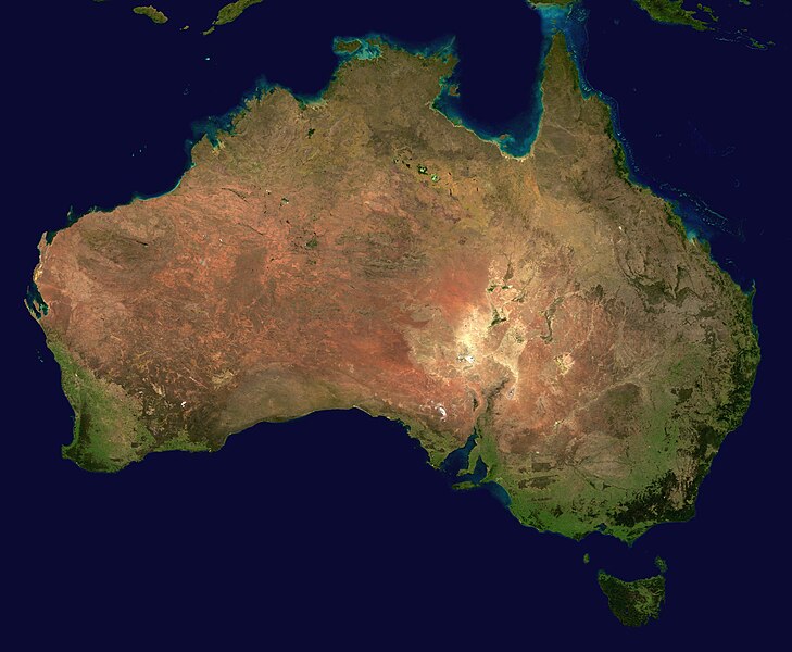
| Mkpọlọ́gwụ̀ | The image is from here, specifically http://visibleearth.nasa.gov/images/2433/land_shallow_topo_east.tif land_shallow_topo_east.tif, which was cropped at 5250x4320+13390+11880. | |||||
| Odé ákwụ́kwọ́ | Reto Stöckl / NASA Goddard Space Flight Center | |||||
| Ọdà (Í jí kwá usòrò nke) |
|
|||||
| Nke ya ozor | Derivative works of this file: Australia satellite states.jpg |

|
Ịta nke usòrò
Bìri èhì/ogè k'ị hụ òtù ụ̀fa dị̀ m̀gbè ahụ̀.
| Èhì/Ogè | Mbọ-aka | Ógólógó na asaá | Òjìème | Nkwute | |
|---|---|---|---|---|---|
| dị ùgbu â | 16:58, 19 Mee 2005 | | 5,250 × 4,320 (1.76 MB) | Dbenbenn | high resolution version. Cropped land_shallow_topo_east.tif at 5250x4320+13390+11880 |
| 21:10, 13 Novemba 2004 |  | 800 × 672 (84 KB) | Bjarki S |
Ojiji faịlụ
Ihe ndị na-eso ihe eji Ihu akwụkwọ eme na faịlụ a:
Ejiji failụ zụrụ ọha
Wikis ndi a edeputara na eji kwa failụ a:
- Ihe eji na af.wikipedia.org
- Ihe eji na an.wikipedia.org
- Ihe eji na ar.wikipedia.org
- Ihe eji na ar.wiktionary.org
- Ihe eji na arz.wikipedia.org
- Ihe eji na ast.wikipedia.org
- Ihe eji na azb.wikipedia.org
- Ihe eji na ba.wikipedia.org
- Ihe eji na be-tarask.wikipedia.org
- Ihe eji na be.wikipedia.org
- Ihe eji na bh.wikipedia.org
- Ihe eji na bn.wikipedia.org
- Ihe eji na bo.wikipedia.org
- Ihe eji na br.wikipedia.org
- Ihe eji na ca.wikipedia.org
- Ihe eji na ce.wikipedia.org
- Ihe eji na ckb.wikipedia.org
- Ihe eji na cs.wikipedia.org
- Ihe eji na cy.wiktionary.org
- Ihe eji na da.wikipedia.org
- Ihe eji na de.wikipedia.org
- Ihe eji na de.wikivoyage.org
- Ihe eji na de.wiktionary.org
- Ihe eji na diq.wikipedia.org
- Ihe eji na dz.wikipedia.org
- Ihe eji na el.wikipedia.org
- Ihe eji na en.wikipedia.org
Lee more global usage of this file.