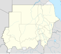
Faịlụ:Sudan location map.svg

Size of this PNG preview of this SVG file: 684 × 600 piksels. Ndị ọzọ mkpebi:274 × 240 piksels | 548 × 480 piksels | 876 × 768 piksels | 1,168 × 1,024 piksels | 2,336 × 2,048 piksels | 1,654 × 1,450 piksels.
Failụ si na nke mbu (usòrò SVG, nà áhà pixel 1,654 × 1,450, ívụ usòrò: 249 KB)
Ịta nke usòrò
Bìri èhì/ogè k'ị hụ òtù ụ̀fa dị̀ m̀gbè ahụ̀.
| Èhì/Ogè | Mbọ-aka | Ógólógó na asaá | Òjìème | Nkwute | |
|---|---|---|---|---|---|
| dị ùgbu â | 06:17, 28 Jụn 2017 |  | 1,654 × 1,450 (249 KB) | SUM1 | Updated as per 2013 Kurdufan reform |
| 10:52, 25 Jenụwarị 2013 |  | 1,654 × 1,450 (245 KB) | NordNordWest | upd | |
| 20:46, 16 Ọgọọst 2011 |  | 1,654 × 1,450 (258 KB) | Spesh531 | fixing opacity | |
| 20:43, 16 Ọgọọst 2011 |  | 1,654 × 1,450 (258 KB) | Spesh531 | fixing the borders | |
| 20:32, 16 Ọgọọst 2011 |  | 1,654 × 1,450 (258 KB) | Spesh531 | adding a disputed territory | |
| 19:21, 21 Jụn 2011 |  | 1,654 × 1,450 (241 KB) | NordNordWest | upd | |
| 13:17, 10 Febụwarị 2011 |  | 1,654 × 1,450 (240 KB) | NordNordWest | update, new Sudan | |
| 18:16, 26 Jụn 2010 |  | 1,654 × 1,956 (392 KB) | NordNordWest | upd | |
| 16:23, 22 Septemba 2009 |  | 1,654 × 1,956 (650 KB) | NordNordWest | ||
| 19:17, 16 Septemba 2009 |  | 1,654 × 1,956 (607 KB) | NordNordWest | =={{int:filedesc}}== {{Information |Description= {{de|Positionskarte von Sudan, '''Vorversion'''}} Quadratische Plattkarte, N-S-Streckung 103 %. Geographische Begrenzung der Karte: * N: 23.3° N * S: 3.2° N * W: 21.5° O * O: 39.0° O {{en| |
Ojiji faịlụ
Ọdighi ihuakwụkwọ nwere failụ a.
Ejiji failụ zụrụ ọha
Wikis ndi a edeputara na eji kwa failụ a:
- Ihe eji na ace.wikipedia.org
- Ihe eji na af.wikipedia.org
- Ihe eji na am.wikipedia.org
- Ihe eji na ar.wikipedia.org
- Ihe eji na av.wikipedia.org
- Ihe eji na az.wikipedia.org
- Ihe eji na be-tarask.wikipedia.org
- Ihe eji na be.wikipedia.org
- Ihe eji na bg.wikipedia.org
- Ihe eji na bs.wikipedia.org
- Ihe eji na ce.wikipedia.org
Lee more global usage of this file.

