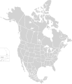
Faịlụ:North America second level political division 2.svg

Size of this PNG preview of this SVG file: 512 × 596 piksels. Ndị ọzọ mkpebi:206 × 240 piksels | 412 × 480 piksels | 660 × 768 piksels | 880 × 1,024 piksels | 1,759 × 2,048 piksels.
Failụ si na nke mbu (usòrò SVG, nà áhà pixel 512 × 596, ívụ usòrò: 132 KB)
Ịta nke usòrò
Bìri èhì/ogè k'ị hụ òtù ụ̀fa dị̀ m̀gbè ahụ̀.
| Èhì/Ogè | Mbọ-aka | Ógólógó na asaá | Òjìème | Nkwute | |
|---|---|---|---|---|---|
| dị ùgbu â | 01:51, 23 Novemba 2020 |  | 512 × 596 (132 KB) | Ponderosapine210 | Added the prominent islands of Manitoulin (Ontario) and Isle Royale (Michigan) to the Great Lakes. |
| 23:07, 1 Jụn 2019 |  | 512 × 596 (130 KB) | Fluffy89502 | added territories, made DC visible, adjusted mexican borders | |
| 12:23, 4 Eprel 2014 |  | 1,712 × 1,992 (270 KB) | Lommes | made the borders between the mexican subdivisions the same size as their canadian / us counterparts. | |
| 23:23, 8 Disemba 2007 |  | 1,712 × 1,992 (327 KB) | Lokal Profil | Code cleanup | |
| 07:55, 7 Ọktoba 2007 |  | 1,712 × 1,992 (342 KB) | AlexCovarrubias | == Summary == {{Information |Description=Map of North America and its second-level political divisions. Canadian provinces, US and Mexican states. Canada, Mexico, United States. |Source=Canada and US map by Alan Rockefeller. Mexico map by Alex Covarrubias |
Ojiji faịlụ
Ọdighi ihuakwụkwọ nwere failụ a.
Ejiji failụ zụrụ ọha
Wikis ndi a edeputara na eji kwa failụ a:
- Ihe eji na en.wikipedia.org
- Ihe eji na sk.wikipedia.org