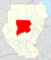
Faịlụ:Locator map Sudan North Kurdufan (CPA).png
Locator_map_Sudan_North_Kurdufan_(CPA).png (683 × 600 pixel, ívù akwukwo orunótu: 142 KB, MIME nke: image/png)
Ịta nke usòrò
Bìri èhì/ogè k'ị hụ òtù ụ̀fa dị̀ m̀gbè ahụ̀.
| Èhì/Ogè | Mbọ-aka | Ógólógó na asaá | Òjìème | Nkwute | |
|---|---|---|---|---|---|
| dị ùgbu â | 10:46, 10 Julaị 2011 |  | 683 × 600 (142 KB) | Пакко | without south sudan |
| 18:18, 8 Febụwarị 2011 |  | 480 × 568 (126 KB) | Пакко | upg | |
| 07:06, 16 Jenụwarị 2011 |  | 507 × 600 (84 KB) | Сержант Кандыба | {{Information |Description={{en|1={{Information |Description=Locator map according to Protocol of Comprehensive Peace Agreement (territory of West Kordofan divided between North and South Kordofan States) |Source=*Vector map from [[:File:Sudan location m |
Ojiji faịlụ
Ihe ndị na-eso ihe eji Ihu akwụkwọ eme na faịlụ a:
Ejiji failụ zụrụ ọha
Wikis ndi a edeputara na eji kwa failụ a:
- Ihe eji na ar.wikipedia.org
- Ihe eji na arz.wikipedia.org
- Ihe eji na ast.wikipedia.org
- Ihe eji na azb.wikipedia.org
- Ihe eji na bg.wikipedia.org
- Ihe eji na ca.wikipedia.org
- Ihe eji na da.wikipedia.org
- Ihe eji na en.wikipedia.org
- Ihe eji na eo.wikipedia.org
- Ihe eji na ha.wikipedia.org
- Ihe eji na id.wikipedia.org
- Ihe eji na la.wikipedia.org
- Ihe eji na ms.wikipedia.org
- Ihe eji na pl.wikipedia.org
- Ihe eji na pl.wikivoyage.org
- Ihe eji na ro.wikipedia.org
- Ihe eji na sv.wikipedia.org
- Ihe eji na ts.wikipedia.org
- Ihe eji na ur.wikipedia.org
- Ihe eji na www.wikidata.org
- Ihe eji na yo.wikipedia.org
- Ihe eji na zu.wikipedia.org
